Karagiye Depression
Journey to the edge of the world. Mars on Earth.
Essential Profile
The Karagiye Depression, known in Kazakh as Vpadina Karagiye, is a large natural basin located in the Mangystau Region of southwestern Kazakhstan. It is recognized as the lowest point in Kazakhstan, with its floor reaching approximately 132 meters below sea level. This makes it of the deeper continental depressions in Asia and a significant geographical feature of the region.
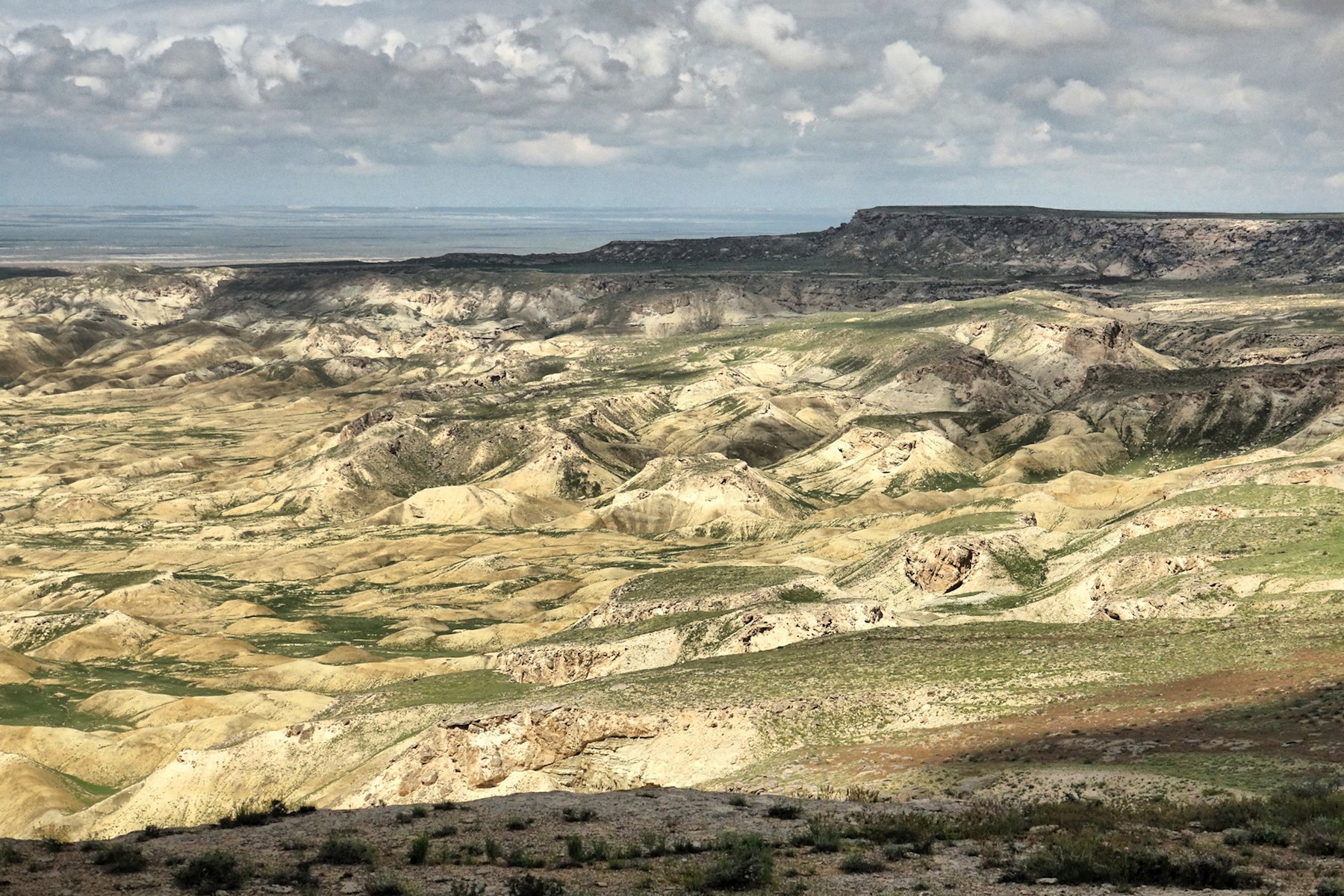
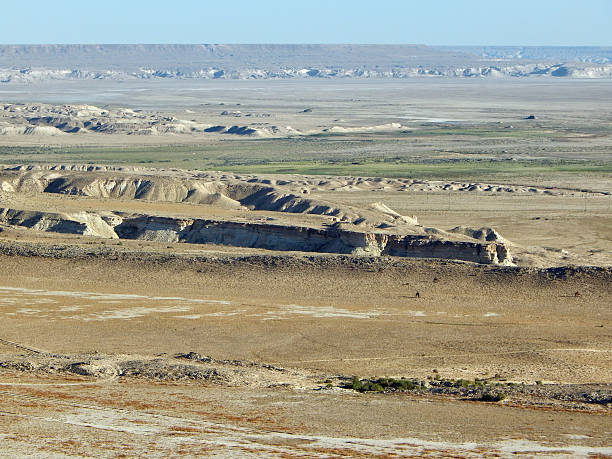
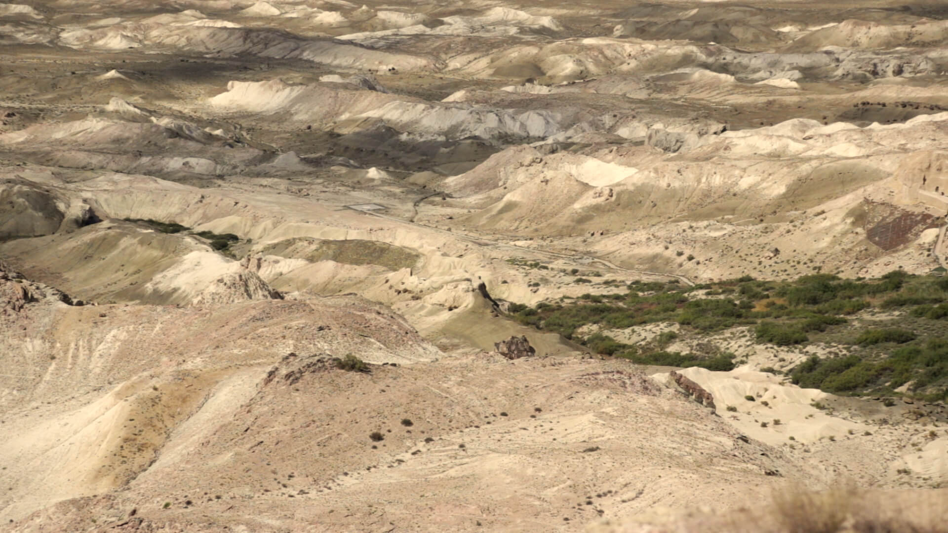
The depression extends roughly 85 kilometers in length and up to 30 kilometers in width. It was formed through a combination of tectonic activity and long-term wind and water erosion acting on the ancient limestone and chalk formations of the Ustyurt Plateau. The basin floor is characterized by salt flats, clay surfaces, and desert terrain, and the surrounding plateau edges drop steeply into the depression in a number of places.
The Karagiye Depression is located approximately 50 kilometers southeast of the city of Aktau, which serves as the main urban base for visitors coming to the region. The site is accessible by road from Aktau, though the terrain requires appropriate vehicles for travel into the depression itself. The area is sparsely populated and facilities are minimal, making it primarily a destination for visitors interested in the region's distinctive geological landscape and the broader Mangystau natural environment.
The ‘Wow-Factor’
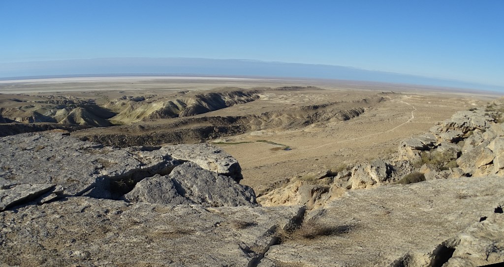
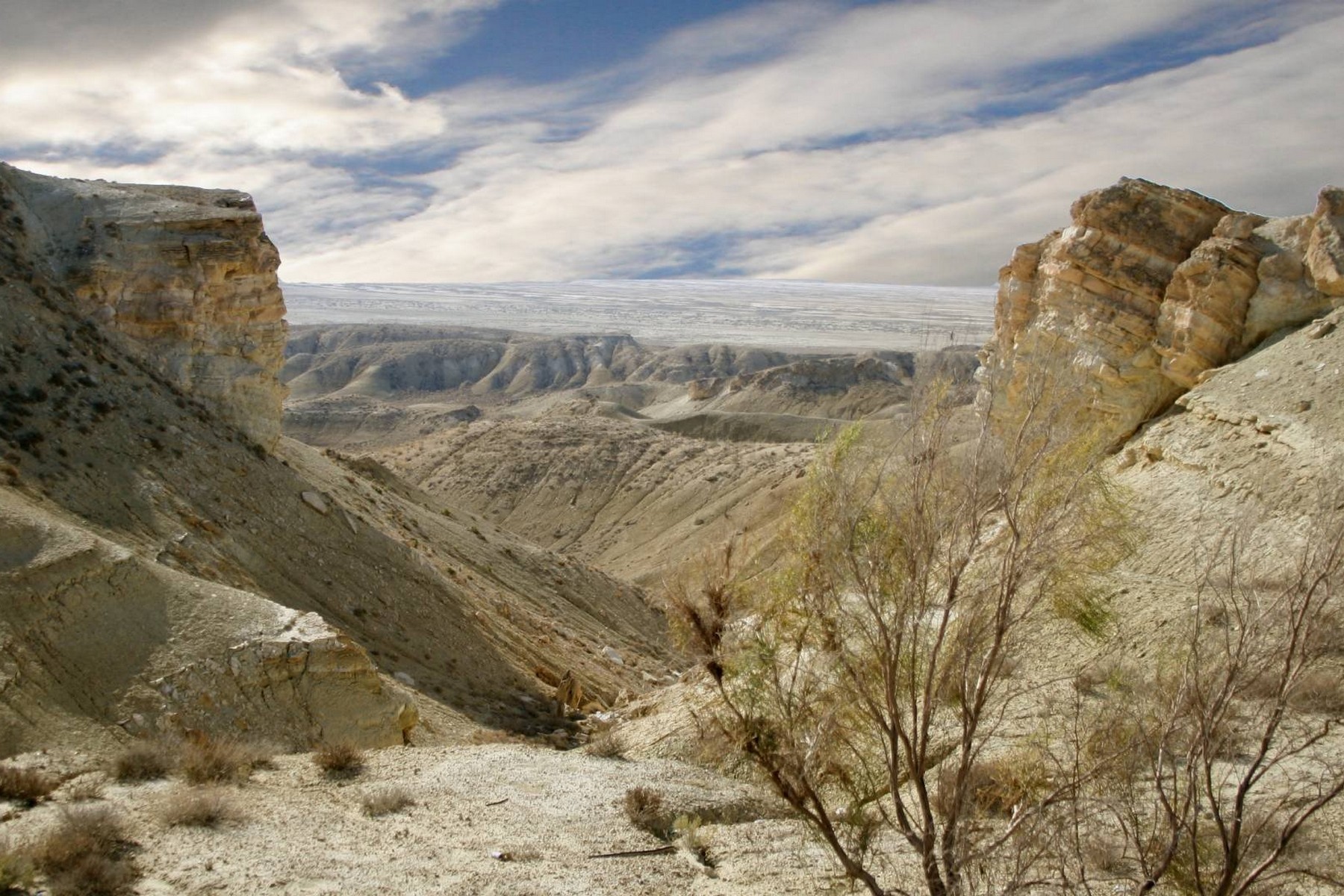
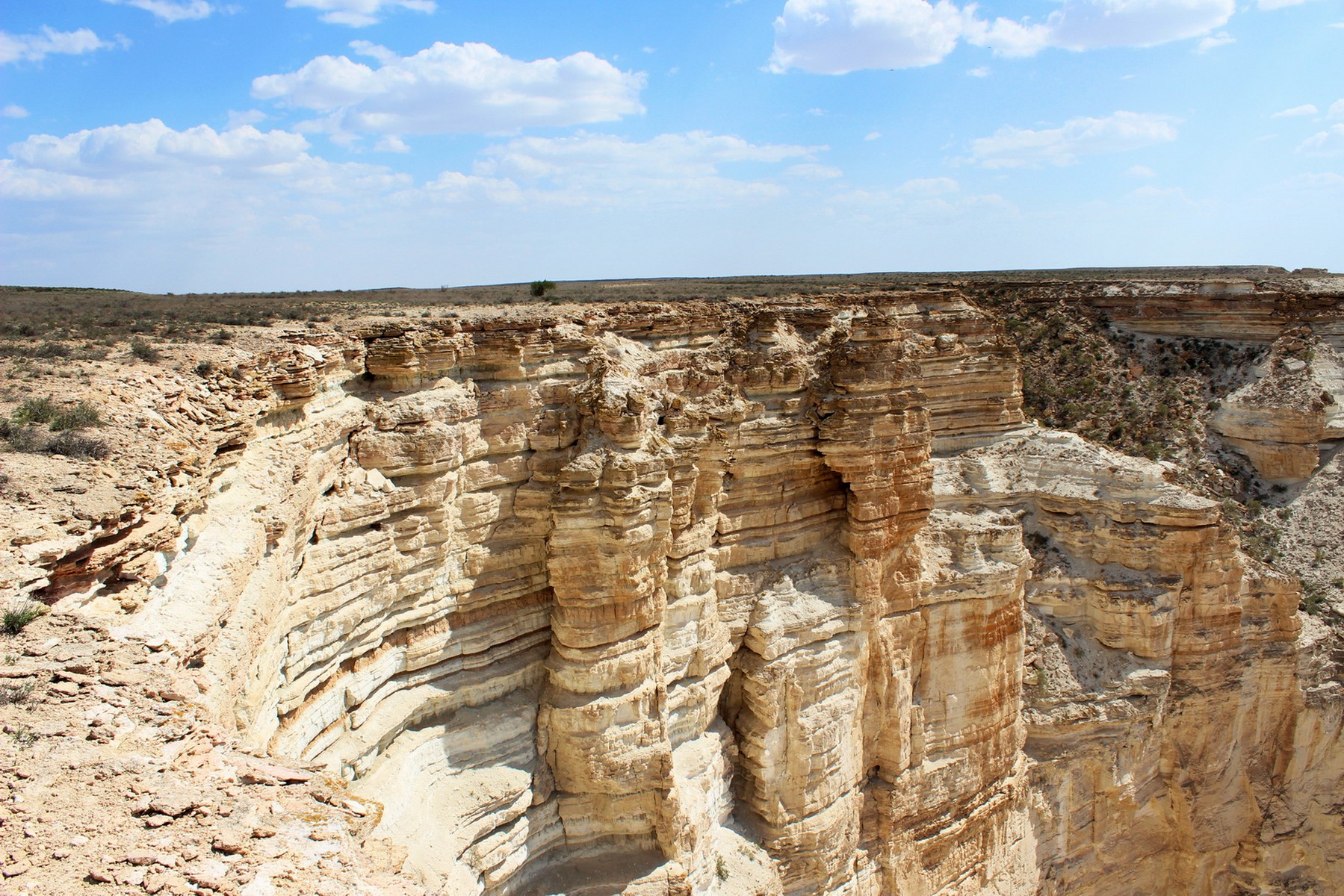
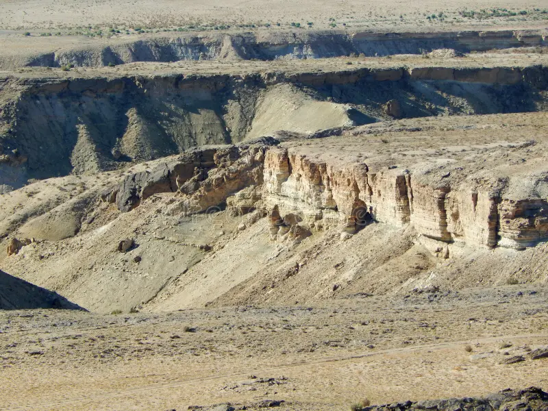
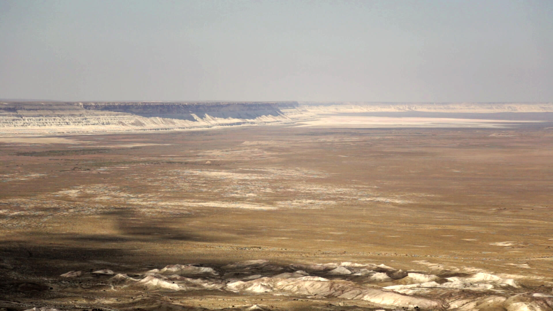
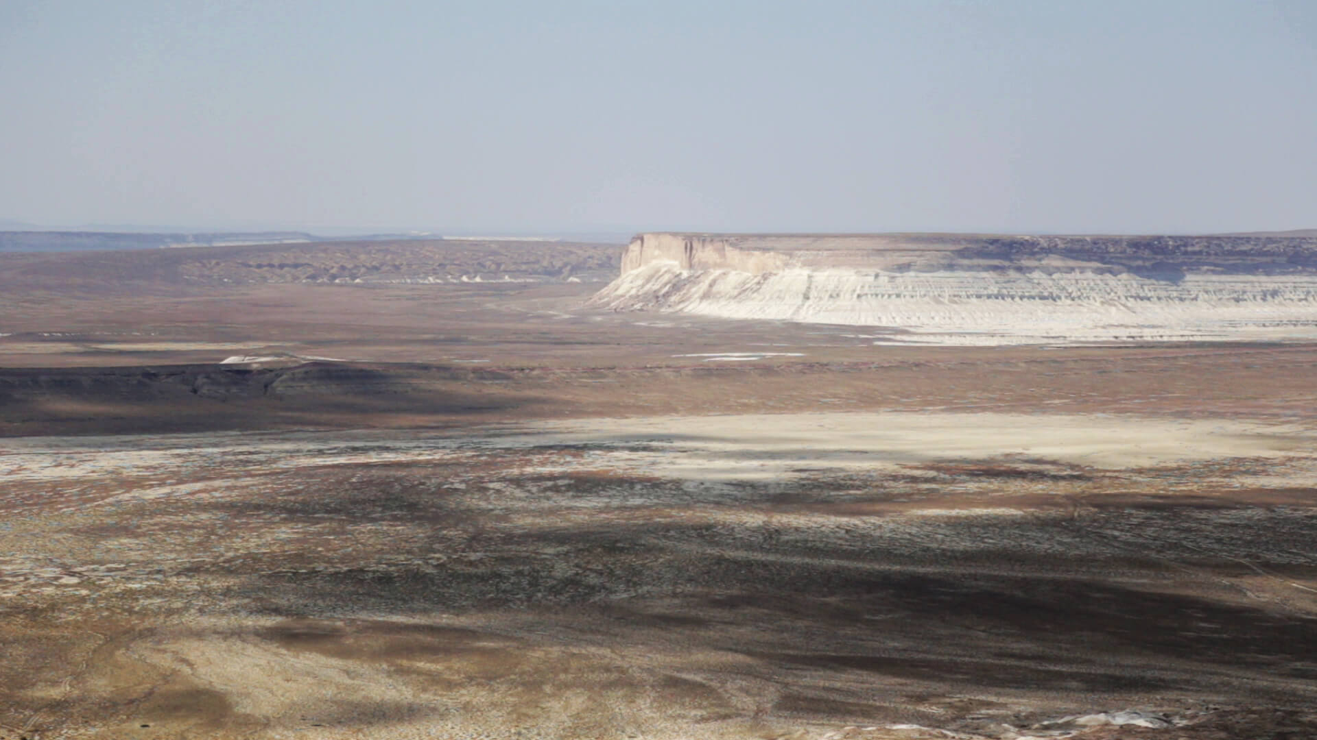
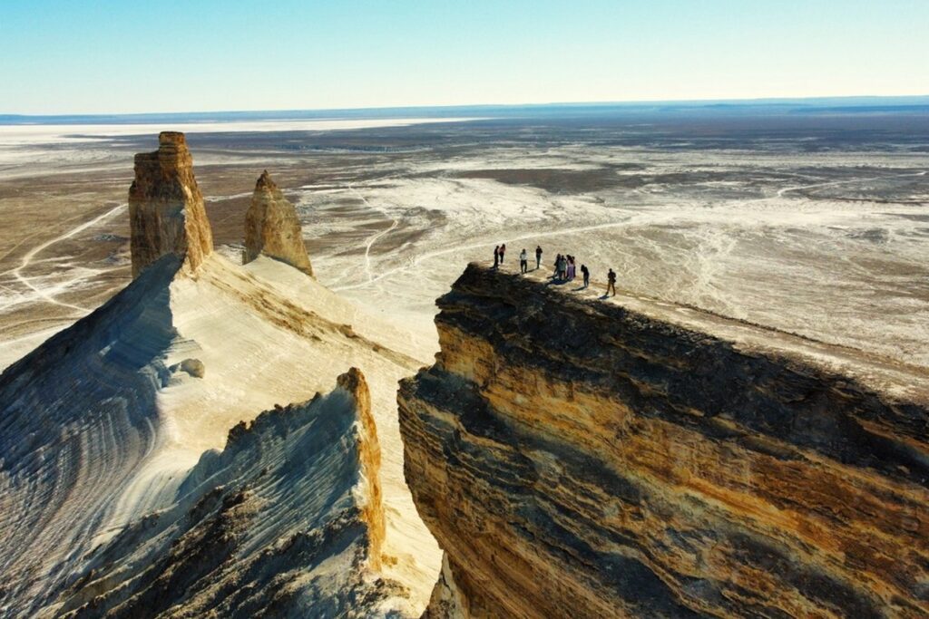
The most striking aspect of the Karagiye Depression is its scale and depth when viewed from the plateau rim. Standing at the edge of the depression, visitors look down into a vast open basin where the floor lies more than 130 meters below the surrounding plateau surface. The visual impact of this abrupt elevation change, combined with the wide extent of the basin, distinguishes Karagiye from other landscapes in the region.
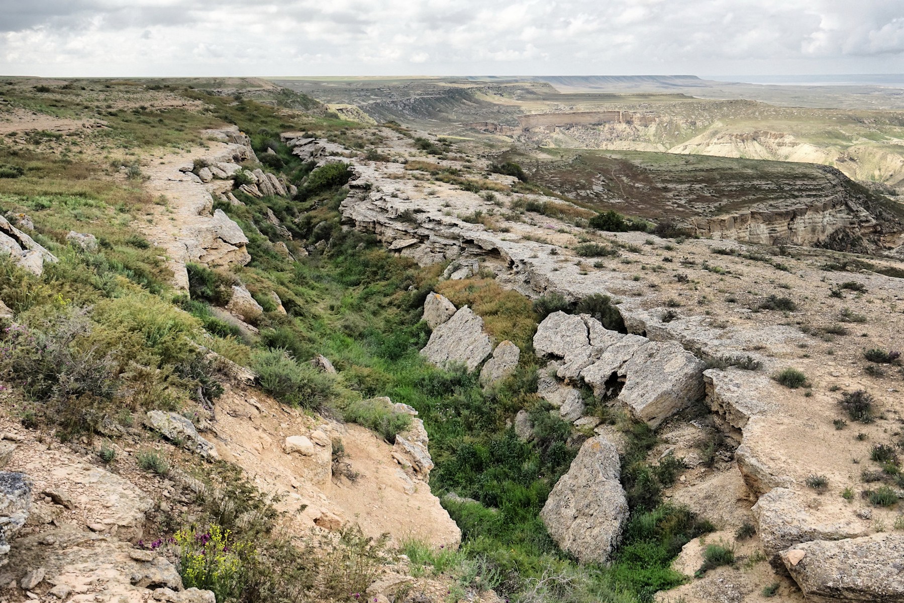
The terrain within the depression is characterized by salt flats, cracked clay pans, and areas of sparse desert vegetation adapted to the harsh conditions at the basin floor. The chalk and limestone cliffs that form parts of the depression wall display layered geological strata representative of the Caspian region's sedimentary history. The coloration of these formations varies from white to ochre depending on mineral composition and angle of light.
The silence and isolation of the depression, combined with its extreme topography, give the site a quality that is uncommon in more frequently visited destinations. The open sky above the wide basin and the absence of urban infrastructure make the site particularly notable for those interested in remote natural landscapes. The descent into the depression itself changes the sensory experience significantly, as temperature and wind conditions at the basin floor differ from those on the surrounding plateau.
Deep History & Culture
The name Karagiye derives from a Kazakh word meaning roughly "Black Mouth," a reference that reflects the impression the deep, open depression made on the nomadic communities who lived across the Mangystau steppe. The vast basin would have been a prominent and disorienting feature in an otherwise flat landscape, and local traditions assigned it significance as a place of unusual and potentially dangerous character.
Geologically, the depression is associated with the ancient Tethys Ocean, whose sedimentary deposits underlie much of the Caspian region. The limestone and chalk formations of the surrounding Ustyurt Plateau represent marine sediments laid down over tens of millions of years during the Mesozoic and Cenozoic eras. The depression itself formed through tectonic processes and subsequent wind erosion that removed material from the basin floor over geological time.
During the Soviet period, the Karagiye Depression was studied by geologists as part of broader surveys of the Mangystau region's natural resources and geology. The Mangystau Region as a whole has significant oil and gas reserves, and geological mapping of the area's unusual landforms, including Karagiye, was part of that broader scientific effort. Today the depression is recognized as of the most distinctive natural landforms in Kazakhstan and is associated with the broader cultural and natural heritage of the Mangystau Region.
Practical Digital Logistics
The city of Aktau is the main gateway for visiting the Karagiye Depression, located approximately 50 kilometers to the northwest. The road between Aktau and the depression area is paved for most of the route, though the final approach to the rim and any descent into the basin requires a vehicle with suitable clearance. A four-wheel-drive vehicle is advisable for those planning to travel into the basin floor, as the terrain includes loose sand and uneven limestone surfaces.
Public transport connections between Aktau and the Karagiye area are limited, and most visitors arrive by private vehicle or as part of organized tours departing from Aktau. Tour operators based in Aktau offer excursions to the depression, often in combination with other Mangystau natural sites. Travelers planning independent visits should arrange transport in Aktau before departing.
Water and food should be carried in sufficient quantity from Aktau, as there are no permanent service facilities at the depression site. Summer temperatures in the basin can be significantly higher than on the surrounding plateau, and the lack of shade makes adequate water supply essential. Mobile phone coverage is unreliable at the site. Those planning overnight stays at the rim should come fully self-sufficient with camping equipment. Visitors should inform someone of their plans before traveling to this remote area.
Must-Do Activities
The main activity at the Karagiye Depression is exploring the rim and, for those with appropriate vehicles, descending into the basin floor. Walking along the plateau rim provides views into the depression from above and allows visitors to examine the cliff and escarpment geology at closer range. The descent to the basin floor is possible via tracks accessible by four-wheel-drive vehicle, and the floor itself offers a different perspective on the scale of the depression from ground level.
The site is suitable for photography, particularly in the morning and late afternoon when lower sun angles illuminate the cliff faces and salt flat surfaces more distinctly. The absence of light pollution in the surrounding area makes the site well-suited for nighttime sky observation, as the Mangystau steppe is remote from significant urban light sources.
The Mangystau Region contains a number of natural and historical sites in relatively close proximity to Karagiye, including the Valley of Balls near Torysh, ancient underground mosques, and the Caspian shore near Aktau. Visitors to the depression often combine it with other regional destinations as part of a broader exploration of Mangystau. Planning for such combined visits requires sufficient time and a reliable vehicle, as distances between sites in the region are considerable and road quality varies.
Local Flavors & Amenities
There are no food or accommodation facilities at the Karagiye Depression itself. All supplies must be brought from Aktau or other towns before arriving at the site. The nearest small settlement to the depression is the village of Zhetibay, located approximately 20 kilometers away, which has very basic facilities but is not a reliable source of visitor services.
Actau, as the regional center, has the full range of accommodation options expected of a mid-sized Kazakhstani city, from budget guesthouses to larger hotels. Most visitors to Karagiye base themselves in Aktau for the duration of their stay in the region. Restaurants in Aktau serve a mix of Kazakhstani, Russian, and general Central Asian cuisine. Traditional dishes such as shashlik, plov, and beshbarmak are available at local establishments. Shubat, a fermented camel's milk drink, is a regional specialty available in the Mangystau area.
For independent travelers visiting the depression, full self-sufficiency is essential. This includes carrying enough water for the duration of the visit, as the site has no water sources, food for the trip, and appropriate emergency provisions. Camping at the rim is possible and allows for extended visits, but there are no managed camping facilities at the site.
Essential Insider Tips
Visiting the Karagiye Depression during summer requires careful attention to heat management. Temperatures on the basin floor can be significantly higher than on the surrounding plateau, particularly during midday hours. Visiting in the early morning or late afternoon is advisable both for comfort and for better photographic conditions as the lower sun angle illuminates the geological formations more distinctly.
The salt flat areas of the basin floor can have unstable surface conditions in places. What appears to be solid ground may have soft or waterlogged material beneath a dry crust. Visitors descending to the floor should probe uncertain-looking surfaces before walking on them and should not venture alone into unfamiliar sections of the depression floor.
Adequate sun protection is essential at this site. The open, treeless terrain offers no shade, and the reflective surface of the salt flats increases solar exposure. Sun protection clothing, a wide-brimmed hat, and sunscreen are necessary items. Carrying significantly more water than might expect to need is wise, as the dry heat and physical exertion of the terrain can lead to rapid dehydration. Visitors should always tell someone outside the area where they are going and when they expect to return before setting out for this remote site.
Sustainability & Community
The Karagiye Depression is a remote natural site with no permanent management infrastructure, which places responsibility for minimizing environmental impact directly on visitors. The basin and surrounding area have no waste collection facilities, so all waste brought to the site must be carried out by the visitors who bring it. This principle applies equally to camping areas at the rim.
The Mangystau Region has limited local economic activity outside of the oil and gas industry, and the communities in the area depend on a modest but growing visitor flow to support small-scale commercial activity. Purchasing local products and using locally operated tour services in Aktau contributes to the regional economy. Artisan goods, including hand-knitted wool items and other crafts produced by communities in the Mangystau Region, are available at markets in Aktau.
Visitors should treat the site with care given its status as a significant natural landmark. Off-road driving on fragile desert surfaces causes lasting damage to the terrain, and visitors should remain on established tracks where they exist. The flora of the Mangystau steppe, including drought-tolerant perennials and spring ephemerals, is adapted to the harsh conditions of the region and is vulnerable to disturbance from vehicle traffic and foot pressure off established paths.
Key Facts
- Global Depth
- At 132 meters below sea level, Karagiye is one of the deepest dry land depressions in the world and the lowest point in the former USSR.
- Black Mouth
- The name means 'Black Mouth' in Turkic, referring to the dark appearance of the depression when viewed from the surrounding plateau.
- Micro-Climate Zone
- The depression creates its own weather patterns, where hot rising air can cause rapid changes in cloud formation and vertical visibility.
- Desert Oasis
- Despite its depth, the depression contains several brackish lakes and springs that support rare flora including wild poplars and tamarisk.
- Geological Scale
- Stretching for over 40 kilometers, the depression's scale is so massive that the other side is often lost in desert haze.
- Biodiversity Hub
- The vertical walls of the depression are a primary sanctuary for the Ustyurt mouflon (wild sheep) and the rare golden eagle.
Photo Gallery
Embedded Video
Karagiye Depression
Loading map...Loading map...
FAQ
Have a question?
Ask and get answers in seconds!
Discussion 0
No comments yet. Start the conversation!
Leave a Reply